1. تعارف
The Garmin ECHOMAP UHD2 63sv is a 6-inch touchscreen chartplotter designed for marine navigation and fishfinding. It features advanced sonar capabilities, detailed cartography, and seamless connectivity options to enhance your experience on the water. This manual provides essential information to help you get the most out of your device.

Figure 1: Garmin ECHOMAP UHD2 63sv Chartplotter with GT54 Transducer.
2. دٻي ۾ ڇا آهي
- ايڪو ميپ UHD2 6 انچ چارٽ پلاٽر
- GT54 transducer
- پاور / ڊيٽا ڪيبل
- جھڪاءُ/گھمندڙ مائونٽ
- فلش جبل
- Protective sun cover
- هارڊويئر
- دستاويزي
3. سيٽ اپ ۽ تنصيب
Proper installation is crucial for optimal performance. Refer to the included documentation for detailed mounting instructions specific to your vessel.
3.1 چڙهڻ جا اختيار
- Tilt/Swivel Mount: ترتيب ڏيڻ جي اجازت ڏئي ٿو viewing angles.
- فلش جبل: Provides a sleek, integrated look into your dashboard.
3.2 Transducer تنصيب
The GT54 transducer is included for comprehensive sonar capabilities. Follow the transducer installation guide for correct placement and wiring to ensure accurate depth and fishfinding data.
3.3 Power and Data Connections
Connect the power/data cable to your boat's power source and the chartplotter. Ensure all connections are secure and waterproof. The device supports NMEA 2000® networks for integration with compatible marine electronics.
4. Operating Your ECHOMAP UHD2 63sv
The ECHOMAP UHD2 63sv features an easy-to-use touchscreen with keyed-assist controls.
4.1 Sonar Capabilities

Figure 2: Sonar Support on ECHOMAP UHD2.
- گارمن روايتي سونار: Provides clear, sharp fish arches.
- ClearVü™ Scanning Sonar: Offers vivid color palettes for clear, high-contrast views below your boat.
- SideVü™ Scanning Sonar: Delivers vivid color palettes for clear, high-contrast views to the sides of your boat.
- LiveScope™ Sonar Systems: The ECHOMAP UHD2 supports LiveScope sonar systems for real-time views.
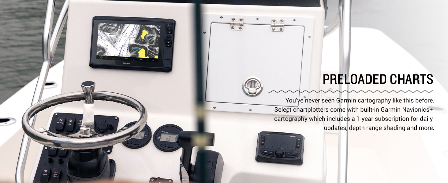
Figure 3: Vivid color palettes for enhanced sonar clarity.
4.2 Navigation and Cartography
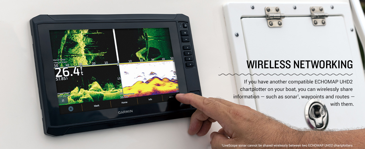
Figure 4: Preloaded Garmin Navionics+ cartography.
- Garmin Navionics+™ Cartography: Navigate with built-in U.S. Inland maps, featuring integrated Navionics data covering over 18,000 lakes with up to 1’ contours. Includes a 1-year subscription for daily updates.
- ملٽي بينڊ جي پي ايس: Experience improved position accuracy, especially in areas where signals are reflected or weak.
- ActiveCaptain® App: Pair with the free all-in-one ActiveCaptain app on your compatible smartphone for access to OneChart™, software updates, and Quickdraw™ Community data.
- Force™ Trolling Motor Integration: روٽس ٺاهڻ ۽ فالو ڪرڻ، وي پوائنٽس تي نيويگيٽ ڪرڻ، رفتار کي ڪنٽرول ڪرڻ، ۽ بيٽري جي زندگي چيڪ ڪرڻ لاءِ وائرليس طور تي پنهنجي فورس ٽرولنگ موٽر سان ڳنڍيو.
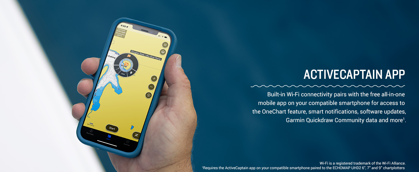
Figure 5: ActiveCaptain App connectivity.
4.3 وائرليس نيٽ ورڪنگ

Figure 6: Wireless networking between ECHOMAP UHD2 units.
Built-in Wi-Fi® connectivity allows you to wirelessly share sonar, waypoints, and routes with another compatible ECHOMAP UHD2 chartplotter on your boat. Note: LiveScope sonar cannot be shared wirelessly between two ECHOMAP UHD2 chartplotters.
وڊيو 1: ختمview of the Garmin Echomap UHD2 Series. This video provides a general introduction to the features and capabilities of the ECHOMAP UHD2 series.
5. سار سنڀال
Regular maintenance ensures the longevity and optimal performance of your ECHOMAP UHD2 63sv.
- ڊسپلي جي صفائي: Use a clean, soft, lint-free cloth and a mild glass cleaner. Avoid abrasive cleaners or solvents.
- سافٽ ويئر اپڊيٽ: Periodically check for software updates via the ActiveCaptain app to ensure you have the latest features and improvements.
- ٽرانسڊيوسر جي سنڀال: Inspect the transducer regularly for marine growth or damage. Clean with a soft cloth and mild soap if necessary.
6. مسئلا حل ڪرڻ
If you encounter issues with your ECHOMAP UHD2 63sv, try the following basic troubleshooting steps:
- طاقت ناهي: Check all power connections, fuses, and the boat's battery. Ensure the power cable is securely connected to the device.
- سونار ڊيٽا ناهي: Verify the transducer is properly connected to the chartplotter and is submerged in water. Check sonar settings for correct frequency and range.
- جي پي ايس جي غلطي: پڪ ڪريو ته ڊوائيس صاف آهي view of the sky. Check for any obstructions that might block the GPS signal.
- ڊسپلي مسئلا: Adjust brightness and contrast settings. If the screen is unresponsive, try restarting the device.
For more detailed troubleshooting, refer to the comprehensive owner's manual available on the Garmin website or through the ActiveCaptain app.
7. وضاحتون
| خاصيت | تفصيل |
|---|---|
| برانڊ | گرمين |
| ماڊل نالو | گارمين ايڪو ميپ 6" |
| شيون ماڊل نمبر | 010-02680-01 |
| اسڪرين جي ماپ | 6 انچ |
| ڊسپلي جو قسم | WVGA, TN |
| طاقت جو ذريعو | بيٽري سان هلندڙ |
| ڪنيڪشن ٽيڪنالاجيز | وائي فائي |
| خاص خاصيتون | ٽچ اسڪرين |
| پيداوار جي ماپ | 8.1 x 5.2 x 2.6 انچ |
| شيءِ جو وزن | 5.85 پائونڊ |
| يو پي سي | 753759307806 |
8. وارنٽي ۽ سپورٽ
For warranty information, please refer to the warranty card included with your product or visit the official Garmin website. Garmin provides comprehensive customer support and resources.
- آن لائن سپورٽ: گهمڻ گارمين.com/ سپورٽ پراڊڪٽ مينوئل، اڪثر پڇيا ويندڙ سوال، ۽ سافٽ ويئر اپڊيٽ لاءِ.
- رابطي جي حمايت: For direct assistance, contact Garmin customer service through their website or the provided contact numbers in your product documentation.


